Copper Ridge/Chilliwack River Loop
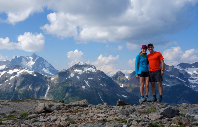
We first explored the Hannegan Peak and the surrounding area last year, when we took a weekend backpacking trip with Katy’s brother, Mitch.
All three of us were struggling with some injuries back then, and we couldn’t get permits for the entire Chiliwack River loop. While we saw some amazing terrain, we didn’t fully experience it.
As a result Katy and I have had this trip firmly planted on the “to-do” list. However, in the year since we were last here, we started trail running, so naturally this shifted from the “to-backpack” list onto the “to-run” list.
The Copper Ridge-Chilliwack River Loop starts at the Hannegan Peak trail head, runs into the North Cascades National Park, and then, following the loop counter clockwise, descends along the Chilliwack River heading northeast until it turns north, crosses the river. From here it climbs up to Copper Ridge, past a gorgeous lookout, and then back to Hannegan Pass. The views of the North Pickets subrange of the Cascades are amazing.
We decided to make a quality weekend out of it, but opted out of fastpacking this time around. We hauled comfy backpacking gear (the tent, warmer clothes, and most importantly, a growler filled with Boundary Bay IPA) and scored one of the most prime camping spots I’ve ever had: on the summit of Hannegan Peak.
With a long running day ahead, we left the trailhead at 5:00am. The sun rose and illuminated Ruth Mountain’s huge north-aspect glacier above us as we hiked to Hannegan Pass and then up to Hannegan Peak.
At the top we unpacked, set up the tent, and ditched the packs and beer in a handful of minutes. We stuffed food, lightweight ten essentials, a layer, and a water filter into our trail running packs, and were off. Our goal was to complete the loop from Hannegan Peak in one day. At 27 miles from start to finish, it would be our longest trail run yet, and that wasn’t counting the extra 6 to get to the camp that morning.
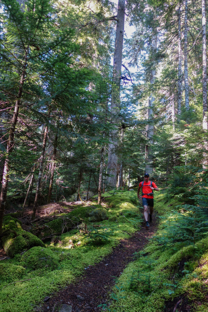
The first half of the loop was fast and cool as we descended down to the Chilliwack river. Verdant moss seemed to illuminate the trail on either side. We made quick work through old growth forest, took an entertaining cable car over the first Chilliwack River crossing, and continued on to the far northwestern side of the loop before it turns back and climbs the ridge.
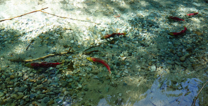
We took a short photo break at the second river crossing here, and for good reason: this time of year, sockeye salmon run back from the Pacific Ocean to spawn in this river. It was a surreal sight: this section of the Chilliwack was calm, clear, and swimming-pool blue. Huge, bright red Sockeye Salmon were suspended in the water, occasionally swimming from one shoal of fish to another. It was an amazing to see in person, and it was a relief to find a downed tree over the river so that we didn’t have to disturb the fish as we crossed.
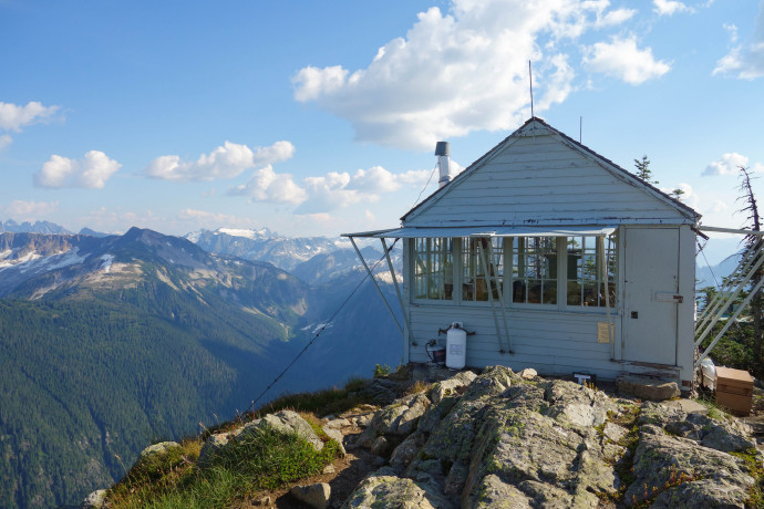
After crossing the Chilliwack, we began the 3400′ climb to Copper Ridge. The first half was sloggy switchbacks in the woods, but soon the views began to open up: vast vistas of the Picket Range, one of the most rugged and wildest parts of the North Cascades. We continued along the ridge toward Copper Lake and the Lookout. The intimidating headwalls and glaciers of Whatcom, Challenger, Fury, Red, Crooked Thumb, Easy, and Mineral peaks peered over us from the South.
The weather on the ridge was spectacular: a cool westerly breeze was light enough to keep from being a headwind, but enough to cool us against the sun. Our spirits were high, though our energy was starting to deplete as we climbed to Copper Mountain Lookout.
Past the lookout, we refueled, enjoyed the view, and then continued on along the ridge. Somewhere along the descent back to Boundary Camp the leg fatigue started to set in. In an effort to keep moving, we missed a necessary break (or two) in which we should have fueled. By the time we got to Boundary Camp, I was crashing pretty hard.
We refilled our water, ate the last of our food, and willed ourselves to finish. We had just about 2 miles and ~1,700′ feet to get to our camp. The power hike to Hannegan Pass was manageable. The climb from the pass to our tent at the summit, for me, was another story. Katy helped drag me up one step and vertical foot at a time. As we climbed the last 300′ feet or so, the sun dipped to golden hour. However my brain and body were mush — I was tired to the point of not appreciating it.
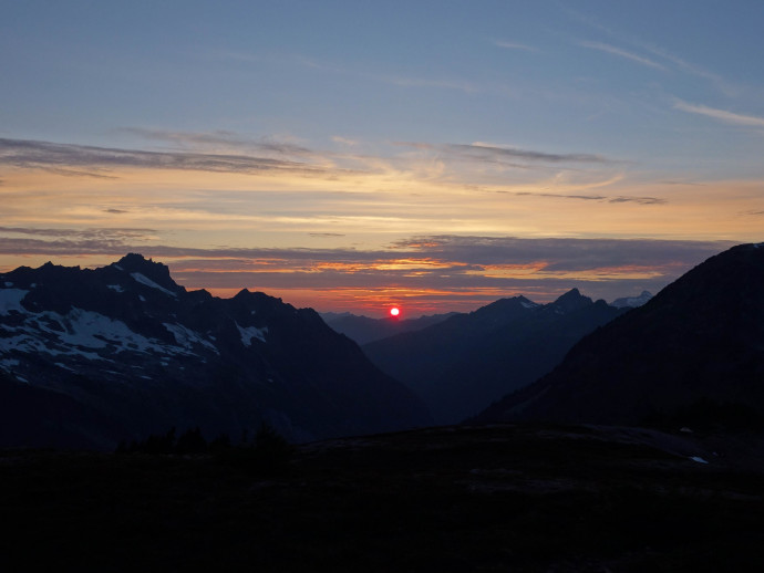
After we finally got to camp, having spent all my energy on the run, I was having trouble staying warm. Katy took full care of me in my heat-less, energy-less state. Before I knew it, I was bundled in all my layers, inside both my and Katy’s sleeping bag, sipping on, alternatively, hot tea and beer. Not sure which worked better, but I think it was the beer. After the hot drinks and a warm meal I felt better enough to catch the last bit of sunset over the northwest Cascades. The panorama of Ruth Mountain, Shuksan, Mt Baker, and the dramatic Nooksack Ridge, all lit up in the cool hues of dusk was one of those countless “how did I get here” moments.
We settled in for an excellent night of sleep, and awoke to another clear morning with 360-degree views of the mountains. Sometimes it’s hard to believe this is all in our ‘backyard’.
After a quick morning jog along the ridge towards Granite Mountain (we decided to save the scramble for another day) we packed up camp, and hauled our stuff back to the trailhead.
This run and this weekend left me in absolute awe of how beautiful the pacific northwest is. If there was a single backpacking or trail-running loop I’d recommend to someone right now, it’d be this one. Perhaps that’ll change as Katy and I continue to explore our neck of the woods, but the views here were just unbelievable. People sometimes say the North Cascades are “America’s Alps”. After this trip, I think they are a category of their own.
As usual, photo highlights below.
The rest of the album can found on flickr: https://www.flickr.com/photos/elygerbin/sets/72157647057400376
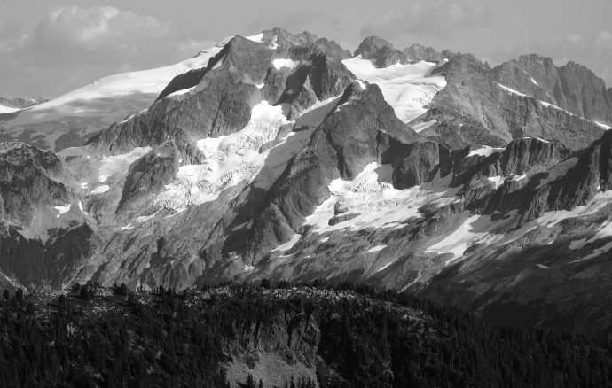
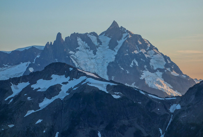
Whatcom and Challenger from Copper Ridge. (If you’re a pro mtn ID-er and I’ve got this wrong, please correct me! I’m going off of maps)


